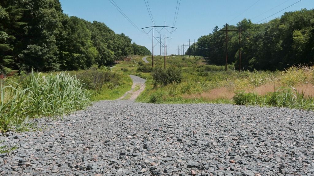

Here's a tough one for even the most seasoned barefooters.
The primary access into the Burlington Landlocked Forest is from
a half-mile of angular-graveled track under a power line. The
moment you step out of your car, you are faced with the rough
stuff shown here. There are some opportunities along the
stretch to enter the woods earlier, but "shreddin' the gnar" *
along the entire length of power-line road will really wake up
your dog-pads for the day! Even just reaching the nearest trail
opening requires going across some of the gravel, so this one
is not recommended for tenderfoots.

The Landlocked Forest itself is another hidden gem, a substantial
parcel preserved by the town of Burlington, tucked in right along
Route 3 where it takes off northward from I-95. Driving to it is
a wander through a residential Lexington neighborhood off of 4/225.
There's sort of a halfass "Friends-of" website about the park that
doesn't seem to be very well maintained, but offers some useful
information.

Link-fest follows: [C&P into your browser if needed] ...
landlockedforest.com/llf_map.jpg
shows the general area and roads leading in, and the most
recent trail map seems to be
http://landlockedforest.com/BLLF_map_10.15.pdf
It is also a popular mountain-biking spot, and one fellow
wrote about his own joy of discovering the place:
http://alifemoreawesome.blogspot.com/2011/07/mountain-bike-gnar-burlington.html

Gravel tracks aside, it is a pleasant patch of woods to wander, with
gently rolling terrain and a typical New England mix of foliage,
swamps, pine groves, stone walls, and even remnants of an old
junkyard at the northern end. Intersections and trails are
well-marked, and the thrum of the nearby highway is a steady
reminder as to which way is east.

    ( * http://snowslang.com/shred-the-gnar-meaning/ )
from Hobbit: